Antique Historical World Projection Clip Art Maps, 1500-1900
Usually printed in 3 - 5 business days
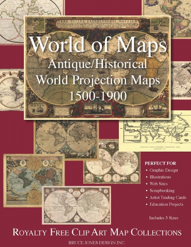
Royalty free clip art collection of Antique and Historical World Projection Maps from 1500-1900s. Maps are perfect for graphic design, illustration, web sites, scrap booking, artist trading card, craft, family heritage books, genealogy, memories, digital scrap booking and educational projects. Includes three different sizes, full page, half page and artist trading card size. Includes 12 vintage, antique maps in high res format perfect for your next project. Maps come from the US Library of Congress Geography and Map division's historical map collections. Maps still retain the lumps and bumps of time. We have done minimal editing to the maps, preferring to keep them as real as possible. You can still see the stain and mold markings, tears and rips from time gone by which will give your projects that wonderful antique feel.
Details
- Publication Date
- Jul 8, 2009
- Language
- English
- Category
- Crafts & Hobbies
- Copyright
- All Rights Reserved - Standard Copyright License
- Contributors
- By (author): bruce jones
Specifications
- Pages
- 36
- Binding
- Saddle Stitch
- Interior Color
- Color
- Dimensions
- US Letter (8.5 x 11 in / 216 x 279 mm)