Union County, N.C. - County Soil Map Atlas
Usually printed in 3 - 5 business days
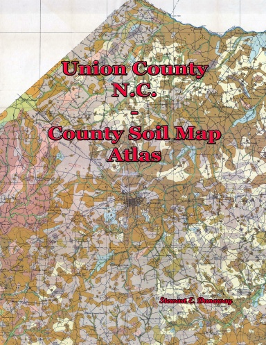
This COLOR book contains cropped images of the 1914 County Soil Map for Union County, N.C. These soil maps contain a lot of historical information. Primarily, church, mills, towns, ferry, bridge, and school names. Each section of the map was cropped to fit one-page in this book, including every name of any item on that part of the map. Then an index is created to catalog every item for the entire county. The index is in the form or River, Name, Creek, Name, School, Name, Church, Name etc. The back cover of this book shows what one-page in this book looks like - from a visual scale, as well as quality of the image. NOTE: No historical information has been added. This is purely an easy way to search these maps in color, in book form.
Details
- Publication Date
- Mar 8, 2018
- Language
- English
- Category
- History
- Copyright
- All Rights Reserved - Standard Copyright License
- Contributors
- By (author): Stewart Dunaway
Specifications
- Pages
- 36
- Binding
- Saddle Stitch
- Interior Color
- Color
- Dimensions
- US Letter (8.5 x 11 in / 216 x 279 mm)